01 September 2012
 |
| Kingston Bridge |
Not even the Paralympics would deter me from my date with the Loop. This was a special day as I would cross the Thames after four years walking on on the dark side. I had the most amazing journey, catching every train as I arrived on the platform. My luck ran out at Wimbledon, narrowly missing the connection that would have got me to Kingston in under two hours. It was a rather overcast day in West London but not cold. Once across the bridge, I went straight into
Bushy Park, one of the lesser known Royal Parks, via the Church Grove Gate.
 |
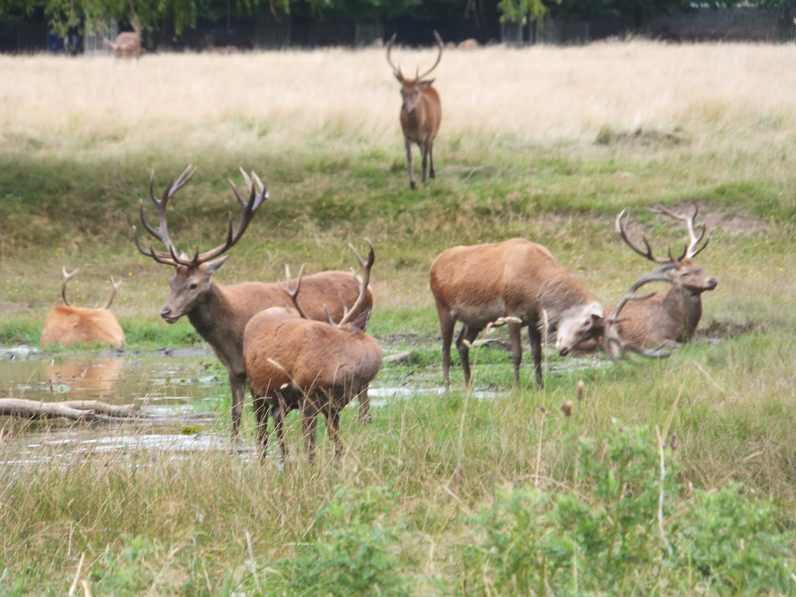
| A Stag Party |
Bushy is the second largest Royal Park after Richmond and has lots of attractions; lakes, grassland and woods and lots of deer. These were the ones I saw on my walk. The ones I didn't see included the
Diana Fountain (goddess not princess) and the
water gardens. It was certainly an interesting walk as I spotted a deer having a paddle, a man collecting water cress from a culvert and lots of lovely model boats. The Loop passed through the
Waterhouse Woodland Gardens, the only point so far not open to dogs. This was full of rhododendrums and must be wonderful in spring. At one point I spotted about twenty stags gathered round a pond, having a few mock fight and lots of roaring, a bit a lad's gathering. They obviously had not read the "Deer Cull" signs.
 |
| Shot Tower |
After the delights of Bushy there was a rather long, boring road section through Hampton to reach
Crane Park near Hospital Bridge Roundabout. The Loop would follow the river Crane for most of the remainder of this section. The
Park is in two boroughs, Richmond and Hounslow, and forms a pleasant wooded corridor in the middle of suburbia. In the centre of the park is a
nature reserve on the site of the old Hounslow Gunpowder Mill. The impressive Shot Tower is only open on Sundays. It was a good spot for my lunch break, but I didn't spot any kingfishers or voles.
 |
| Hounslow Heath |
After another longish road section, the Loop heads west into
Hounslow Heath nature reserve, the last remnant of a huge heath which covered most of south-west Middlesex. The Heath has played host to several armies particularly during the Civil War and cavalry used to train there. It was also popular with highwaymen and it still has an air of menace today. It is a very large open space, with lots of scrub, trees and hedge and very few people. It felt very remote despite being under the flight path to Heathrow. It would be quite easy to get lost without the helpful Loop finger posts. Eventually I crossed a golf course and rejoined the river Crane for the last part of the walk.
 |
| Donkey Wood |
The last part of this section passes through Donkey Wood, which was quiet enough to tempt a fox out in broad daylight. The path here was also quite muddy and overgrown. The London Loop leaflets I take with me are excellent and the instructions are usually very clear and accurate. However, unknown to me, the route has changed slightly but significantly, since my leaflet was published in 2005. The path for the last 400 yards has switched banks. I was rather puzzled by this but concluded that I was at the end of the walk and started to walk towards Hatton Cross station. As I was in the wrong place I ended up having a scenic tour of an industrial estate before realising the error of my ways. Luckily I found a bus back to the station but not before I wasted half an hour. I will have to do a mile and half loop to complete this missing bit next time.
 |
| Boats in Bushy Park |
Time for leg
4hr 15m Distance
9¾ miles Time for trip
9hr 05m
Walk log
Fares this leg
£8.50
Section 09 Essentials
Section Map
Directions
Distance and time 8½ miles 4hrs 40m
Walking conditions: Entirely level; mostly on grass and rough footpaths; sections of Bushy Park are subject to flooding; one stile; 2.8m besides roads.


 Bourne Hall


